GC Dataset Importer
Upload a dataset file and turn it into a clean PostgreSQL table in your Guardian Connector data warehouse. The app guides you through naming the dataset, uploading a file, optionally tagging the data source, and finalizing the import. It also saves the original and transformed files to your deployment’s data lake (accessible via Filebrowser).
📦 What this tool does
- Converts and validates common tabular files (
.csv,.xlsx/.xls,.json) to CSV for ingestion - Converts and validates common spatial files (
.geojson,.kml,.gpx,.kmz) to GeoJSON for ingestion - Optionally applies source-specific transformations (e.g., KoboToolbox, CoMapeo, ODK, Locus Map)
- Writes the result to a new Postgres table and archives files to file storage
Step-by-Step: Import a Dataset
1. Open the app in Windmill
From GC Scripts Hub → Apps, click GC Dataset Importer.
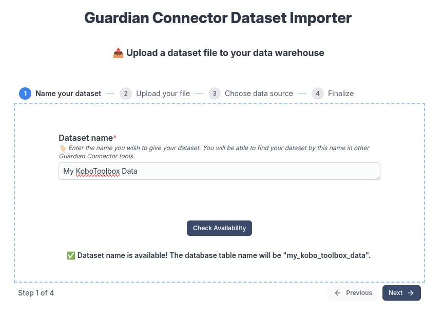
2. Name your dataset
Give your dataset a clear, human-readable name, then click Check Availability.
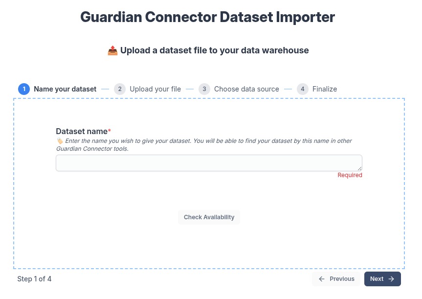
If available, you’ll see the resulting table name you’ll get in the warehouse.
3. Upload your file
Select your file and click Upload File. When the upload completes, proceed to the next step.
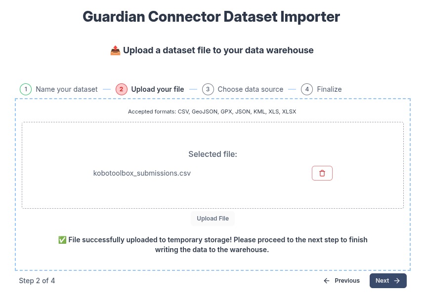
Accepted formats: CSV, GeoJSON, GPX, JSON, KML, XLS, XLSX, KMZ, XML (SMART) (Shapefiles are not yet supported.)
4. (Optional) Choose a known data source
If the file originates from a known tool, toggle Is this dataset from a known source or tool? and select it. This adds a data_source tag and, for some sources, applies smart formatting.
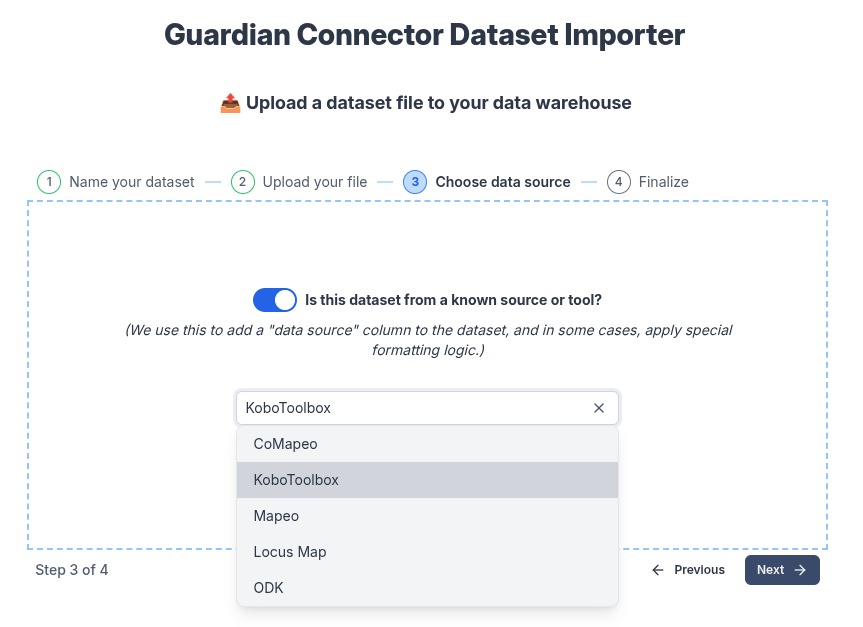
Examples
- KoboToolbox: standardizes survey exports for consistent column names and types
- CoMapeo / Mapeo / Locus Map: normalizes fields for observations and waypoints
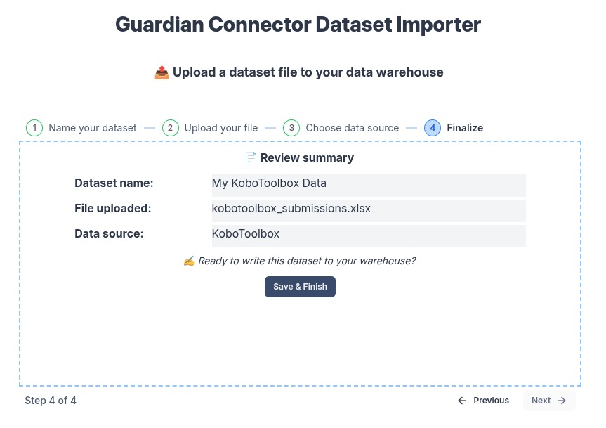
5. Review and finalize
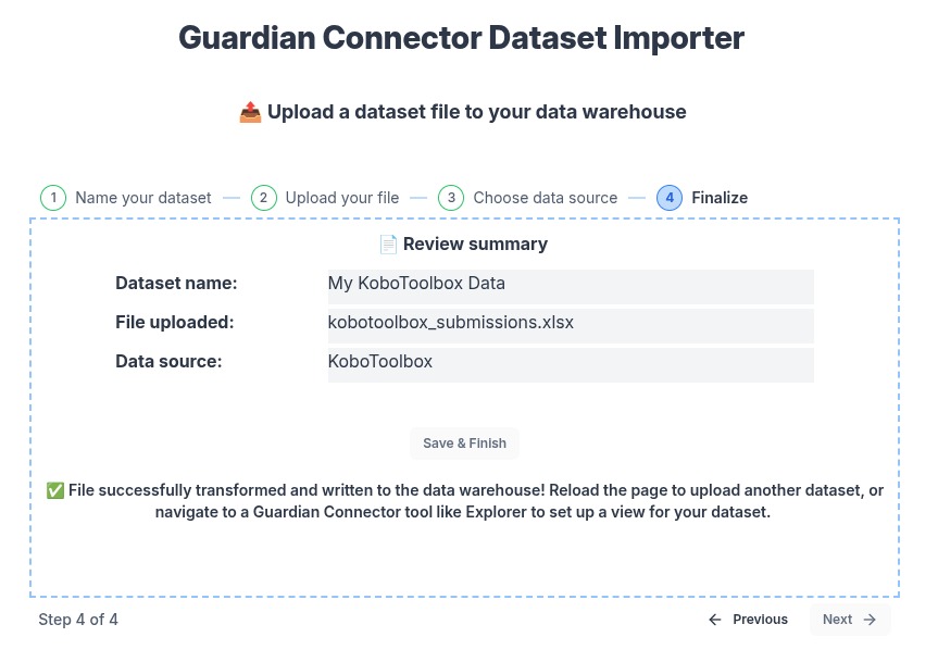
Confirm the summary and click Save & Finish to write the data.
You’ll see a success message when the import is complete.
After You Import
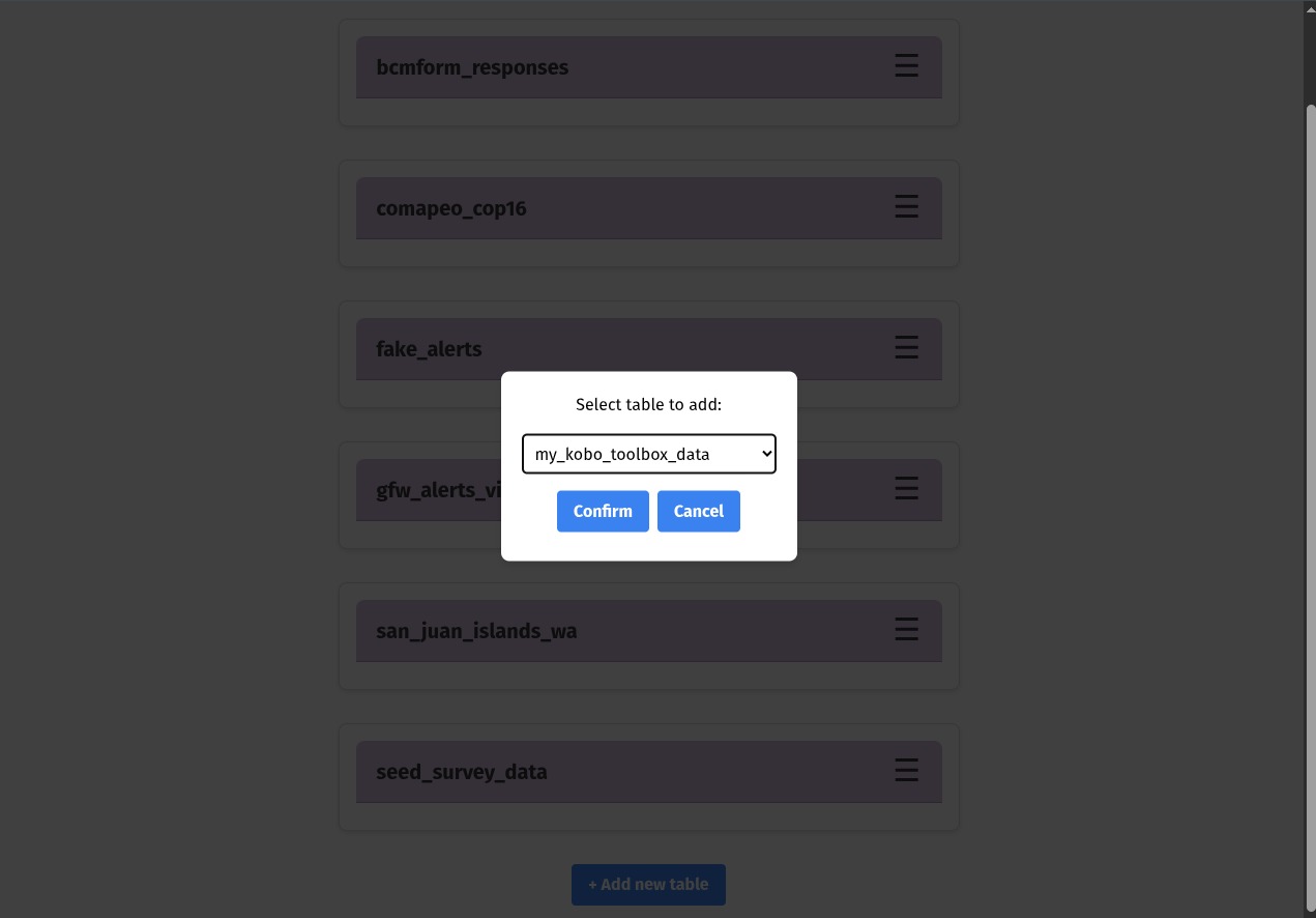
Use your new table in GC Explorer
Open GC Explorer and add your newly created table to a View to explore or publish.
See: GC Explorer
If you are using Superset, or any other tool that uses PostgreSQL as a data source, you can use also access the uploaded data there.
Access your uploaded files in Filebrowser
The importer saves both the original file and any transformed output in a folder named after your table (e.g., my_kobo_toolbox_data).
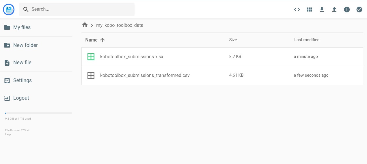
See: Filebrowser for share links or downloads.
If you uploaded a spatial data file, you can download it here to use in a tool like QGIS.
Tips & Troubleshooting
- “⚠️ Dataset name is already in usage.” Pick a different dataset name. The table name must be unique in the warehouse.
- Unsupported file type. Convert it locally to one of the supported formats, then re-upload.
- Large files. If the upload stalls, the file might be too large. Try resizing the file to a smaller size. A recommended maximum size for a file is 5MB on a computer, or 1-2MB on a mobile device.
- Accidental upload. If you accidentally upload a file, but did not click Save & Finish, you can just refresh the page. (It will be cleaned up automatically.) If you did click Save & Finish, the database table will have to be deleted manually. (In the future, we will add a way to delete the table.)
For any other issues, please contact us at guardianconnector@conservationmetrics.com or file an issue on GitHub.
See also
- Technical overview & architecture - for developers, and includes a to-do list for future features.